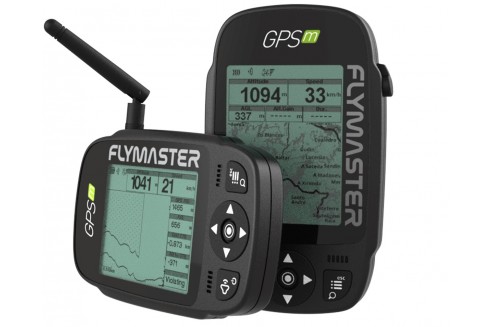
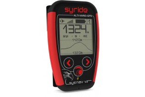
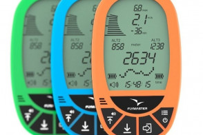
New generation, updated and improved, maintaining the philosophy of Flymaster instruments, everything has been redesigned and built from the ground up, gathering the experience of thousands of Flymaster user pilots around the world.
Characteristics
- Better construction and robustness.
- More modular construction
- Easier repair
- Better visibility in direct sunlight (screen much closer to the protective lens)
- New user interface
- USB Type C
- Mass storage device capacity
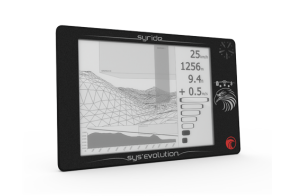
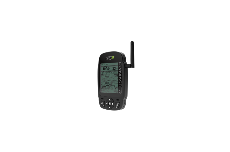
- New "side cut" view (GPS M only)
- Creating IGC for mass storage (SD card)
- New landscape mode
- Larger fonts in landscape mode
- Flarm beacon built in as an option (GPS M only)
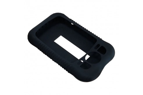
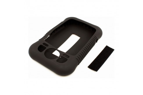
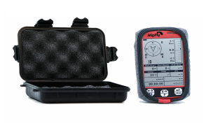
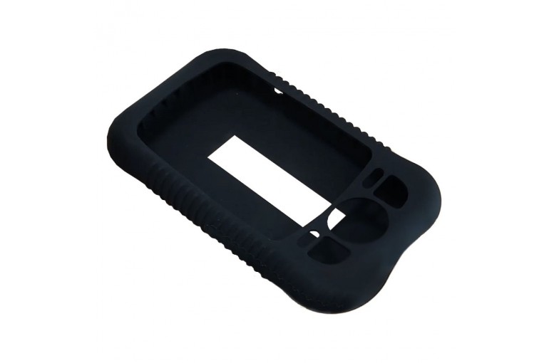
- Optional bumper case
- New buttons for better usability with gloves
- Altitude graph in the instrument flight log
- Improved airspace rendering
- Loading waypoints from a mass storage file (SD card)
- Works with Flymaster Instrument Manager software
- Import designs from the instrument
Optional
- Flytec Bumper silicone case specific for the Flymster M series
- Leg base
- Base for the chair (for the ventral strap of the chair)
Technical Specifications
|
Screen resolution (high contrast grayscale)
|
320x240 pixels
|
|
Screen size (actual display area)
|
76x57 mm
|
|
Battery capacity (lithium-ion)
|
2900 mAh
|
|
Autonomy (depending on use)
|
Approximately 27 hours
|
|
Size
|
152x90x16 mm (Length x Width x Thickness)
|
|
Weight
|
200 gr.
|
|
GPS
|
50 channels/4hz
|
|
Native USB C connection
|
Allows connection to the PC to download/upload flight data, airspace data, etc.
|
|
Battery charging
|
From wall adapter, car adapter or standard USB port
|
|
Micro SD slot
|
Supports cards up to 16 GB. A 16 GB SD card preloaded with airspace, ground data, and maps is now available.
|
|
6-axis accelerometer and magnetometer
|
Allows 6 degrees of freedom Compass with tilt compensation)
|
|
Firmware update via USB (updates are free)
|
Interface features
|
User-definable pages, 8 in portrait mode and 8 in landscape mode (each page can be drawn with FIM software).
|
16
|
|
Configurable graphic elements (depending on the element, several parameters can be set by the user, e.g. Size, Border, ...)
|
11
|
|
Configurable data field elements (user can change size, border, title, font, ...)
|
61
|
|
Page activation events (the page changes automatically if a specific event occurs)
|
- Airspace notice
- Introduction of thermal
- Transition (leaving the thermal)
- Arrival at the turning point
- On
|
|
Multilingual interface
|
- English
- French
- German
- Spanish
- Italian
- Polish
- Slovenia
- Turkish
- Portuguese
|
|
Configurable audible alerts
|
- Airspace
- Complete turning point
|
Variometer/Altimeter Features
- Nearby thermal hum/sound.
- Ultra-sensitive variometer with 10 readings per second and 10 cm resolution.
- Configurable vario digital filter and integration values.
- Vario Sound fully configurable (frequency, increments, frequency/vertical speed ratio,...).
- 6 Sound levels (configurable via menu, or by using a key).
- Automatic mute keeps the vario silent until take-off.
- Altitude adjustment using QNH.
- Automatic altitude adjustment from GPS.
- 2 independent altimeters.
Memory characteristics
- 3D flight recorder in IGC format.
- Storage for >300,000 waypoints.
- Up to 248 flights.
- 448 beacons.
3D Airspace
- Support for Open Air format (file upload via Designer).
- Displaying restricted areas on the map
- Adjustable vertical warning distance to a restricted area
- Adjustable horizontal warning distance to a restricted area
- Display of the shortest vertical and horizontal distance to the restricted area
- Rescued zone alarms (Imminent altitude, Imminent position, Violation, ...)
- Critical Airspace Page (displays information about areas that are closer than a defined distance)
- Global Airspace Database (requires SD card) (more info).
XC Distance Flight Features
- Exclusive thermal ball indicator
- Various specific data files such as takeoff distance, current and average glide ratio, average speed, etc.
- Distance to last thermal indexed with altitude
- Go to waypoint
- Multi-way route
- Wind speed and direction (GPS-based calculations)
- Automatic altitude gain profiler
- Nearby Landings (Shows the required glide ratio and the distance to all landings that can be reached)
Route or tour characteristics
- Various sliding ratios (average, until next,...)
- Definition of easy route
- Route navigation, configurable safety/risk margin at turning points.
- Route map (route with thermal indication)
Interface
- Compatible with MacOS (10.13 and higher), Windows (8/10)


.jpg)